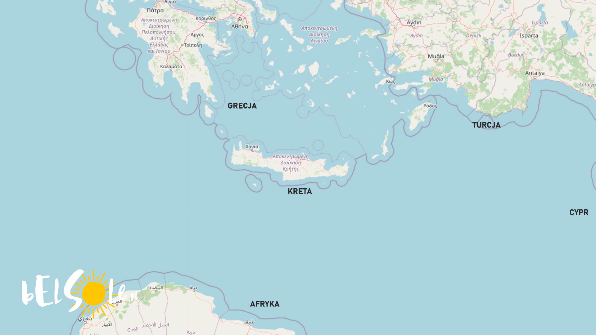
Crete is the largest Greek island located in a funky crossroads between Greece, Turkey and Africa. Basically floating between three continents, you may be wondering which one it calls home? Let’s take a look at that today!

It’s also the 5th largest island in the Mediterranean Sea, with a surface area of 8450 km2. Crete covers two climatic zones, the Mediterranean and the steppe climate. The latter is why you may see almost desert-like areas on Crete. Politically, Crete is part of Greece, which means it’s also part of the European Union and the Schengen Area. This also checks out culturally, as it’s mostly European with a bit of Asia.
Geographical location of Crete
Crete is located 62 miles away from the coast of Europe, 110 miles away from Turkey and 180 miles away from Africa. Despite its proximity to all of these continents and its formal assessed location being semantics, it belongs to Europe. The southern coast of the nearby island, Gavdos, is the southernmost point of Europe, merely 30 miles away from Crete. If you’re curious, we also wrote about the westernmost point of mainland Europe!
Here’s a summary:
- Politically, Crete belongs to Greece, so Europe
- Culturally, Crete is mostly European with a small Asian mix
- Geographically, Crete belongs to Europe
See also:


