

Active holidays are a very popular way of spending one’s time off, with hiking trails becoming more crowded than ever before. What’s the popular destination for climbers? Often the Apennines. But if you haven’t paid much attention during geography classes or you simply have never delved into that part of the world at all, you may not know where the Apennines even are. Don’t worry, we’ve got you.
Where are the Apennine Mountains located?
The Apennine Mountains are located on the peninsula named in their honour, the Apennine Peninsula. Their position on the map also means that the mountain chain is located on the territory of two countries – Italy and San Marino.
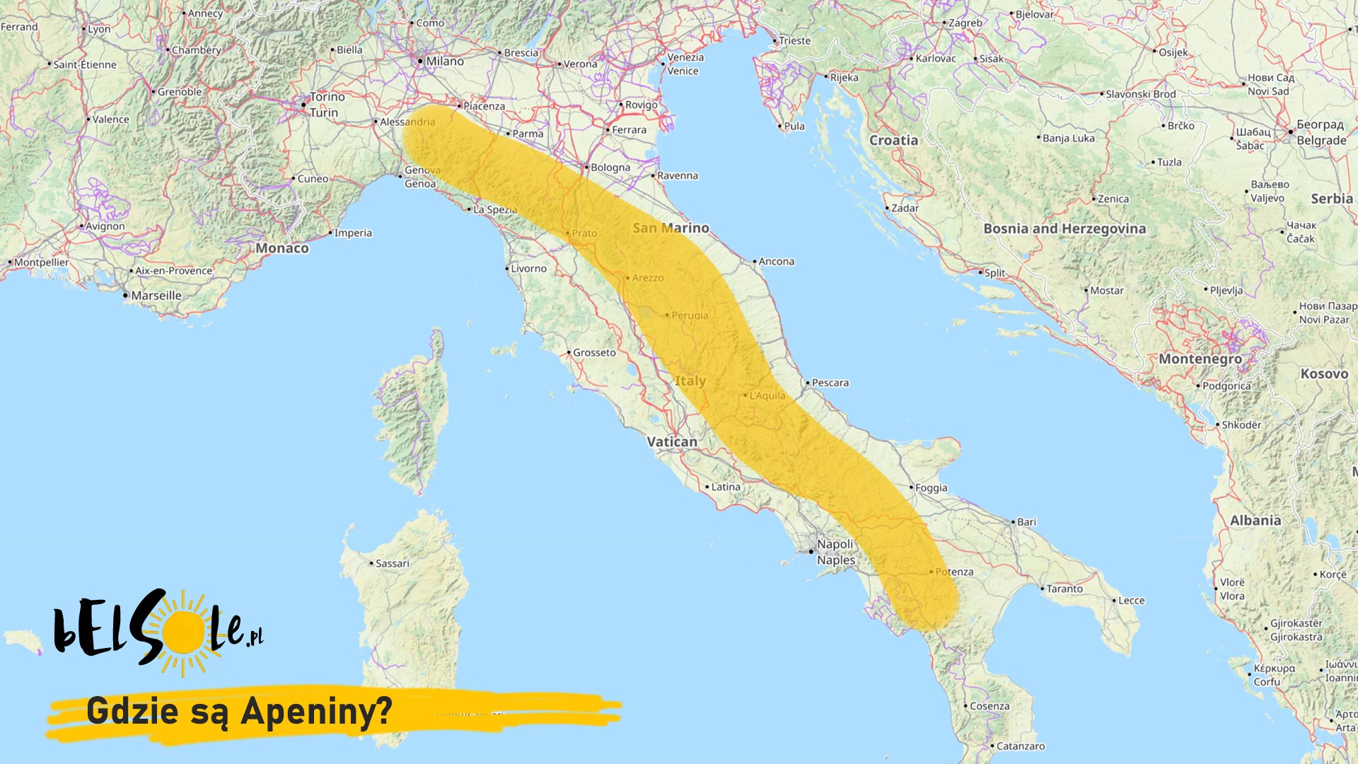
For a more precise answer to the question of where the Apennine Mountains are, we present you a map!
How tall are the Apennine Mountains? What’s the highest peak?
The Apennines extend for about 750 miles along Italy’s coast. The chain is sometimes divided into three parts:
- Northern Apennines
- Central Apennines
- Southern Apennines
How tall are the Apennines? They’re far from the Himalayas, but climbing the highest peak will be quite an achievement nonetheless. The highest peak in the Apennines is Corno Grande, located at 2912 m above sea level.
The Apennines are a very popular destination for mountain trips, and no wonder. It also helps that Italy is a beautiful country in its own right. It’s a great way to mix a bit of hiking with exploration or a bit of nothing at all (you’ve earned it!).
See also: